Jeju Island (Jeju-do)

Finally, I've developed my film to a digital format. These photos are from my disposable camera, so there's not much pixel clarity. Although, I do hope it portrays a brief view of my small adventure.

It was interesting visiting the island in which I desperately wanted to live on. Luckily, I was able to fly on a solo trip to Jeju-do. While the island is only 1,147 square miles, there is still so much more to explore. The last 5 pictures on this posting are from a tour boat ride which left from the southern city of Seogwipo.
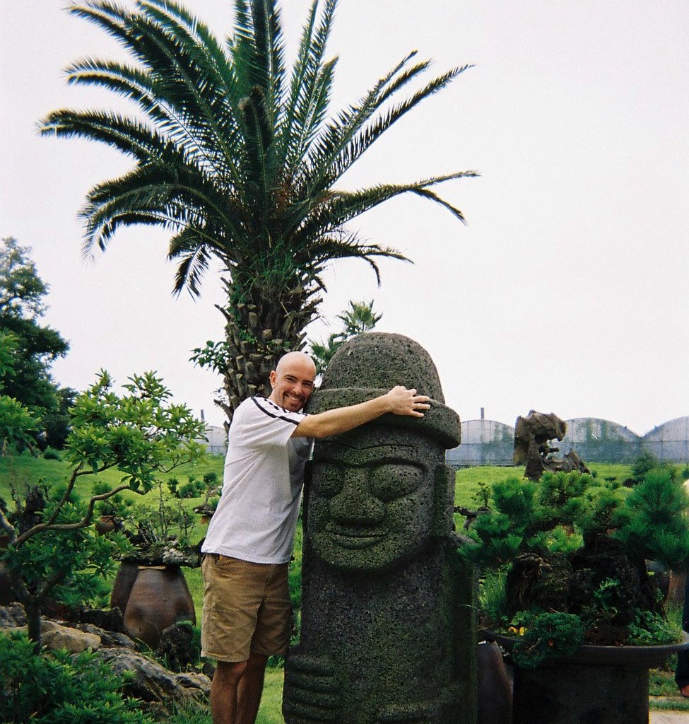
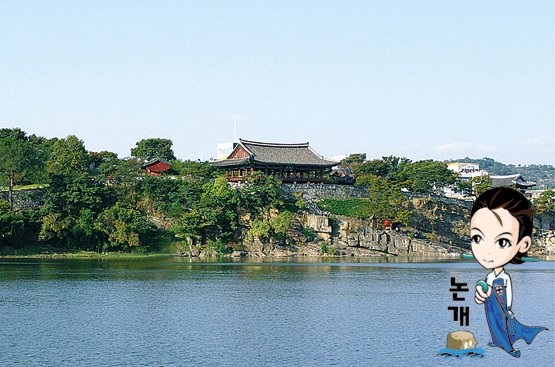
I'm not sure how many times this dolharubang (stone grandfather) has been hugged, but he still seems to enjoy the attention. There were 45 original harubang found on the island by the first settlers. There are many theories as to what purpose they served, but history can't place them. I was informed if you rub its nose you'll get pregnant. I opted against such an action, only because I don't think I'd carry the weight well.


Quiet time in the city of Jeju-si. This side street is in the main city on Jeju Island.
I chose to hike Hallasan which is the highest mountain in S. Korea. Pretty crazy when you consider this mountain is based on a small island. A portion of the hike consisted of volcanic rock.

Yongduam Rock, which is known for its resemblance of a dragon's head. This structure was created from a volcanic lava flow about 2 million years ago.


Hallasan Mountain! The highest peak in S. Korea!
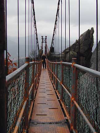

Despite the forced grin, I was very dissapointed I was unable to climb to the peak of Hallasan. It may have been closed for revegetation, but truthfully I'm not sure.


Cheonjiyeon Falls, in which I have Bandar and Muhammad to thank for this photograph.

The boat guide drove us tourists out to this deserted island off the southern coast of Jeju-do. Look at the size of this cave on Beomseom Island. It's easiest if you compare it to the human on the far right side of the picture. Our boat steered into it for a quick close up view.


Jeonbang Waterfall, in the distance, claims to be the only seaside waterfall in Asia. Sorry, no zoom lens on these disposable cameras.


Different caves on Beomseom Island. Once again, capare the size of these caves to the person on the right.


If you enlarge this picture, you can view some of the people on this tiny islet. So, you may have wondered what all these people are doing on this "deserted island"? The island of Beomseom was covered with people fishing all day. I can take a guess, but I'm still not exactly sure how so many people make it out to this island. There was not one boat parked around the whole island for transport.

I now stand corrected from the comment above. The people you see in this picture are out scuba diving. The boat drops them off & they'll radio back in when the group is ready to be picked up. Thanks for informing me Allison! Guess I should have noticed their wetsuits in this photo. Oops...


Behind the tree branches is a free free standing rock named Oedolgae. In the far distance is Beomseom Island.

Please view Jeju-do for more pictures.

Busan APEC- Asian Pacific Economic Cooperation

Friday the 18th was one of the main days President Bush was in town. All public schools had the day off & most English academies joined in for an extended APEC weekend. Drew, Denis, & I went to the main APEC areas in search of all the protest hype. Needless to say, the areas were more deserted than I've ever seen!

Bexco Stadium in the background.


Four important people in the center with guards watching closely.


After a tough day of searching for anything to report back on, we decided to take a break. It's exhausting looking for presidents all day long!

For more pictures, please view them here.

APEC Culture Day in Nampo-dong

The Asian Pacific Economic Cooperation (APEC) was held in town recently. During the extent of APEC, Nampo-dong tailored itself to educating the foreign visitors. Amanda & I decided to advantage of this nearby cultural day event. Traditional Wedding Ceremony

Bride in the middle.


Amanda & I are shown how to properly enjoy tea & rice cake. They were so nice to not laugh at us. My thumb is awkwardly raised & Amanda chose to demonstrate with the wrong hand. In the end, Amanda ended up performing this traditonal practice quite well. I on the other hand, felt it necessary to leave room for improvement. After all, I didn't want to "one up" the ladies who were teaching us.

Traditional rice cake pounding while other children stand in line for different activities. Many people wear masks when ill, so they don't spread it to others.


So why exactly didn't this "Honkey on the Drum" gather a drum circle?

The Korean Tea Ceremony in the Women's Quarter (Kyubang Darye). Kyubang Darye is the ritual ceremony conducted by wives of officials. They invite friends or neighbors to share friendship by preparing & serving tea. In their quarters, they learn virtue & etiquette to be a proper lady through tea ceremony. The ladies in the photo above are those who allowed us to sign the visitor book and also taught us the beginnings of ritual tea ceremonies.


This seesaw, or Neolttwigi, is a traditional folk game for women. I've since tried this with a friend who was wearing high heeled shoes. As one might guess, it didn't work quite as well as you see here.

More pictures from this APEC weekend.

Taejongdae

Drew, Andrea, & I had the chance to visit Taejongdae on Yeongdo (Yeong Island). It was roughly an hour bus ride away & is located on the southernmost tip of Busan. Apparently on a clear day, you can see Tsushima Island in Japan.
We stopped many times for photo opportunities like this.

Taejongdae Lighthouse with eating places near the water.

Taejongdae Jagalmadang


Drew & I show how this military bunker works. I guess our audience behind has already seen this one done.

Feel free to view more pictures at Taejongdae.

Nights in Saha

Random nights on the outskirts of Busan.
One of the local bakeries I enjoy.


This is the beginning of Amanda's birthday celebration!


This Korean nightclub actually does read "Don't Tell Mama".


Yeosu

A few weeks back, Denis & I had the chance to visit some friends in Yeosu. Our hosts, Kristy & Amanda, gave us a quick tour of a small portion of Yeosu. We then made it over to Dolsan Island to capture the photos below.
Geobukseon (Turtle Ship) is considered one of the first (if not the first) ironclad warships in the world. The dragon's head was used for a multitude of purposes. It not only emitted fumes as a smokescreen, but it had a gunport to fire cannons and could be used to ram the sides of warships. This particular ship was rebuilt according to historical findings.
Check out the spiked armor covering the top of this ship. That could be a deterrent to jumping aboard. Admiral Lee Soon-Shin replica in the forefront.
Dolsan Bridge
Dolsan Bridge seen from the top of this island park.

Dolsan Island monument of some sort.

City of Jinju

Months ago, I visited a friend in the town of Jinju. Once again, I didn't have a digital camera. Since my initial visit, I've had the chance to take a couple photos that you'll see first. The other pictures have been "found".

Jinju Fortress Gate picture from www.redbrick.dcu.ie/ ~melmoth/RTW/korea.html

The Jinju Namgang Yudeung (Lantern) Festival.

Here's my attempt at capturing the floats or "lanterns".


Nightime view of the Namgang Lantern Festival. As history books tell, the Imjinwaeran (Japanese invasion) of 1592 was a suffering period for Korea. It was during this time that General Kim Si-Min floated lamplights & torches down the river to send military signals to loyal troops & other support forces outside the castle. These lanterns were used for various communication purposes. Soldiers inside the castle were even able to use the lantern as a means of expressing their safety to their families. Thank you for this picture www.biznetkorea.co.kr.


This picture is overlooking the Namgang River toward the Jinjuseong Castle. Photo compliments of www.newsworld.co.kr/ cont/0503/70.htm.

Wolchulsan National Park

Like the DMZ, I made this trip months ago. This pictorial pseudo-blog is really becoming my diary of sorts. So, I decided to "borrow" some additional pictures for this posting. My appreciation is extended to home.no.net/mariannh/ Korea/korea.html for the first two photos & http://www.redbrick.dcu.ie/~melmoth/RTW/korea.html for the later two.
I was unable to gather any additional pictures of Wolchulsan. It's unfortunate, because it was a very beautiful park.
This bridge was narrow as you can see here. My friend Adrienne & I ended up crossing this a couple times on a crowded day.
While Wolchulsan National Park is the smallest park in S. Korea, it quickly rises above the fields below. It took about 8 hours to hike from one end to the other.

Fairly impressive suspension bridge.

This canyon floor is much lower than pictured here!

DMZ- Demilitarization Zone Near Seoul

The DMZ is a strip of land that stretches across the Korean Peninsula. It serves as a buffer zone between North Korea & South Korea. Technically, these two countries are still at war.
I do have some pictures of me at the DMZ, but none are digital. I've had to borrow these pictures, but kindly provide the credit to http://debrisson.free.fr/dmz3.html for the next two pictures. The last three pictures have been borrowed from http://members.iinet.net.au/~dehere/archives/00000035.html, & I greatly thank them all. As you leave Seoul, these outposts appear more frequently. Long-range artillery are also seen on the southern side of the DMZ.

A series of tunnels from N. Korea were discovered leading under the DMZ. I believe four have been discoverd, the last being found in 1990. Each one has been blown through granite & all lead to S. Korea. When the first tunnel was discovered, it had electricity, railways and paths for vehicles. While difficult to see, this ride on tracks takes you deep into the Third Infiltration Tunnel. Yes, you're required to wear helmets & need them for the low ceiling! When you're inside the tunnel, it provides you an idea of what it has taken to create these.

This is Dorasan Train Station next to the DMZ. It may have opened since I've visited, for a strict trial run to N. Korea. These guards are positioned for picture taking & most of us tourists line up for a photo. Yes, I have the physical picture in my room.

Pictures can only be taken from behind a line not shown here. However, these pay scopes allow you to peak at N. Korea.

The town of Panmunjom is shown here in the distance. Other than this town, the DMZ is devoid of humans and their machinery. I should mention there is still a large number of landmines that exist in the Demilitarization Zone.